Benefits
Featuring innovative technology and design, GEOD builds its foundation upon Cadden´s 20 years of experience in providing integrated solutions. This assures the product line is created to deliver real added-value. GEOD products are renown to be:
Features
Cadden specializes in accurate positioning systems for maritime and industrial applications. GEOD is a brand of products manufactured featuring some key technological assets:
GNSS Constellations
By default, GEOD GNSS receivers are set to work with GPS+Glonass constellations. It is possible to upgrade to Beidou+Galileo via a simple firmware upgrade.
Accurate GNSS
Receivers are powered by Trimble technology.
RTK provides an accuracy of position or 1cm-2cm.
L-Band (RTX) accuracy in the range of 1 decimeter: 4cm -10 cm. While SBAS accuracy 0.5m-1m.
Exact Orientation
Dual-Antenna GNSS compass with Moving Baseline RTK and gyro-aiding are Plug & Play options delivered as part of GEOD core solutions.
NiMH batteries
Each product comes with variations to power the systems with safe batteries.
Hot-swappable batteries for BANANAS, power-bank dual battery system or Power over Ethernet (PoE) cables for G-NAV, BALI features an external battery connector.
Wi-Fi Access Point
Web-based configuration & monitoring software is accessible via Wi-Fi for all of the GEOD products.
Single-Beam Echosounder
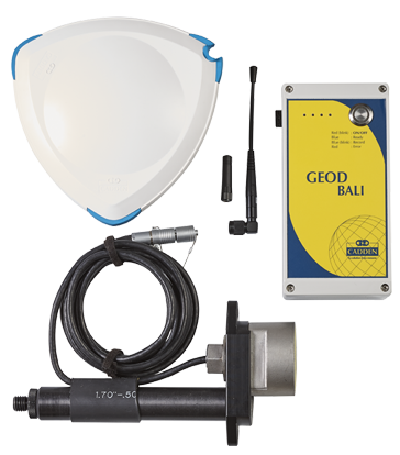
BALI bathymetry kit comes with either a single frequency or a dual frequency echosounder.
Inertial Navigation
GNSS-INS data fusion, MEMS accelerometer, gyro-heading, Kalman Filters are part of GEOD core augmented-GNSS solutions.
Radio Connectivity
All antennas, modems, and firmware to make the GEOD products communicate with various types of radio networks (3G, UHF, VHF, AIS, Wi-Fi, Long-Range Wi-Fi) are built-in.
Relative Positioning
Systems can be used as a relative positioning system, meaning that it is possible to evaluate with extreme accuracy the distance between moving points. Relative positioning has enormous applications in off-shore operations and in the study of vehicle dynamics.
Endless possibilities
With quality components and options precisely designed. GEOD product line finds applications in several domains: maritime, robotics, unmanned vehicles, automotive, industrial automation, e-navigation, hydrography, land surveying, mobile mapping and more...
Smart solutions
Ever wished you could use a solution out-of-the-box designed around your professional needs? GEOD is full on interesting surprises:
Advanced GNSS
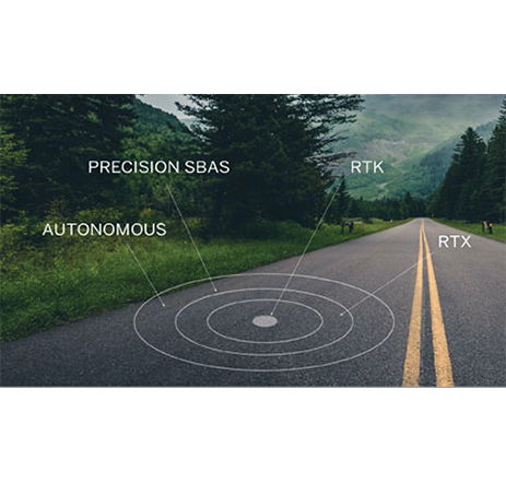
RTK provides an accuracy of position or 1cm-2cm CEP-Horizontal in real-time.
L-Band (RTX) accuracy in the range of 1 decimeter: 4cm -10 cm CEP-Horizontal and is delivered via geostationary satellites. Likewise, SBAS which provides as accuracy 0.5m-1m CEP-Horizontal.
Embedded Software
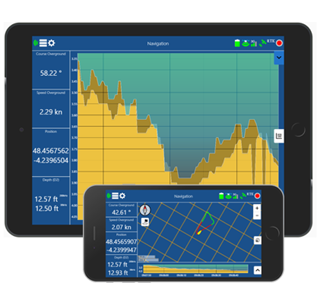
With BALI, hydro surveying is very intuitive. Professional tablets and software are not mandatory, as BALI can work completely standalone or using any smartphone with its built-in software connected via Wi-Fi.
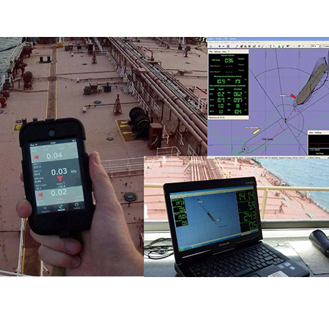
Real-Time Multiple Tracking
Thanks to a proprietary protocol developed, the data exchange amongst beacons is made via UHF radio. It allows several units to share the same channel by dividing the signal into different time slots.
Designed around you
Designing your own bathymetry kit has never been easier. BALI was envisaged as a simple tool, compact and performant. Not everyone can master all challenges presented by integrating hydrographic equipment components. BALI gives all options needed to use a system made to carry out a professional bathymetric survey. All one needs to choose is the depth range, the precision of position sought. All possible options are designed for you.
References
GEOD products are used worldwide for critical missions where precision and reliability are key to success. Here are only 3 references:
BANANAS (Berthing And NavigatioN Aid System) is an Independent Portable Pilot Unit (PPU)
BANANAS PPU was designed valuing ergonomics and the augmented navigation aid provided.
3 Products
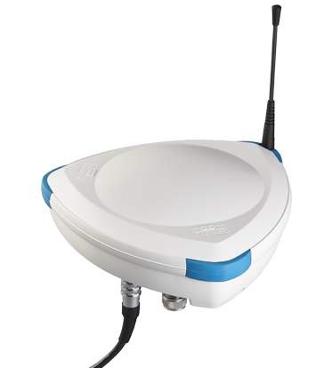
The GE0D product line consists of: a bathymetry kit called BALI, a Portable Pilot Unit (PPU) called BANANAS and a smart antenna called G-NAV


